Gulf Coast Snowstorm Shatters 130‑Year Records, Drops to 7°F in Baton Rouge
When Gulf Coast SnowstormGulf Coast region rolled in from January 20‑22, 2025, it rewrote the climate books for the Deep South. Temperatures plunged to a frosty 7°F (‑14°C) in Baton Rouge, Louisiana, marking the coldest reading in 95 years, while historic snow drifts blanketed cities that rarely see a flake.
Historical Context
For most of the 20th century, snowfall on the Gulf Coast was the stuff of anecdotes. The February 1895 storm held the record for over a century, delivering modest drifts that still felt extraordinary. The 2014 winter event, once deemed the benchmark, was eclipsed by the January 2025 blizzard, which produced the region's deepest snow‑to‑liquid ratios—up to 15:1—creating powdery snow more common in Rocky Mountain resorts than in the subtropics.
"We haven't seen this combination of Arctic air and Gulf moisture since the late 1800s," said Dr. Emily Harper, a climatologist at Louisiana State University. "The snowfall depth records broken in Mobile and Pensacola are statistically significant outliers that suggest a shift in the jet‑stream patterns for this winter."
Snowfall Totals and Records
The snowfall totals were staggering:
- New Orleans, Louisiana – 8 inches (20 cm)
- Mobile, Alabama – 7.5 inches (19 cm), a new two‑day record surpassing the 1895 mark of 6 inches
- Pensacola, Florida – 8.9 inches (23 cm), busting the old two‑day high of 3 inches
- Eastern North Carolina – pockets of 6‑9 inches, with Washington reporting 4.2 inches, Bath 5.0 inches, and Aurora 5.5 inches
According to the National Weather Service office in Mobile, the snow‑to‑liquid ratio ranged from 10:1 to 15:1, turning a modest amount of moisture into an outsized snowpack.
Transportation and Economic Disruptions
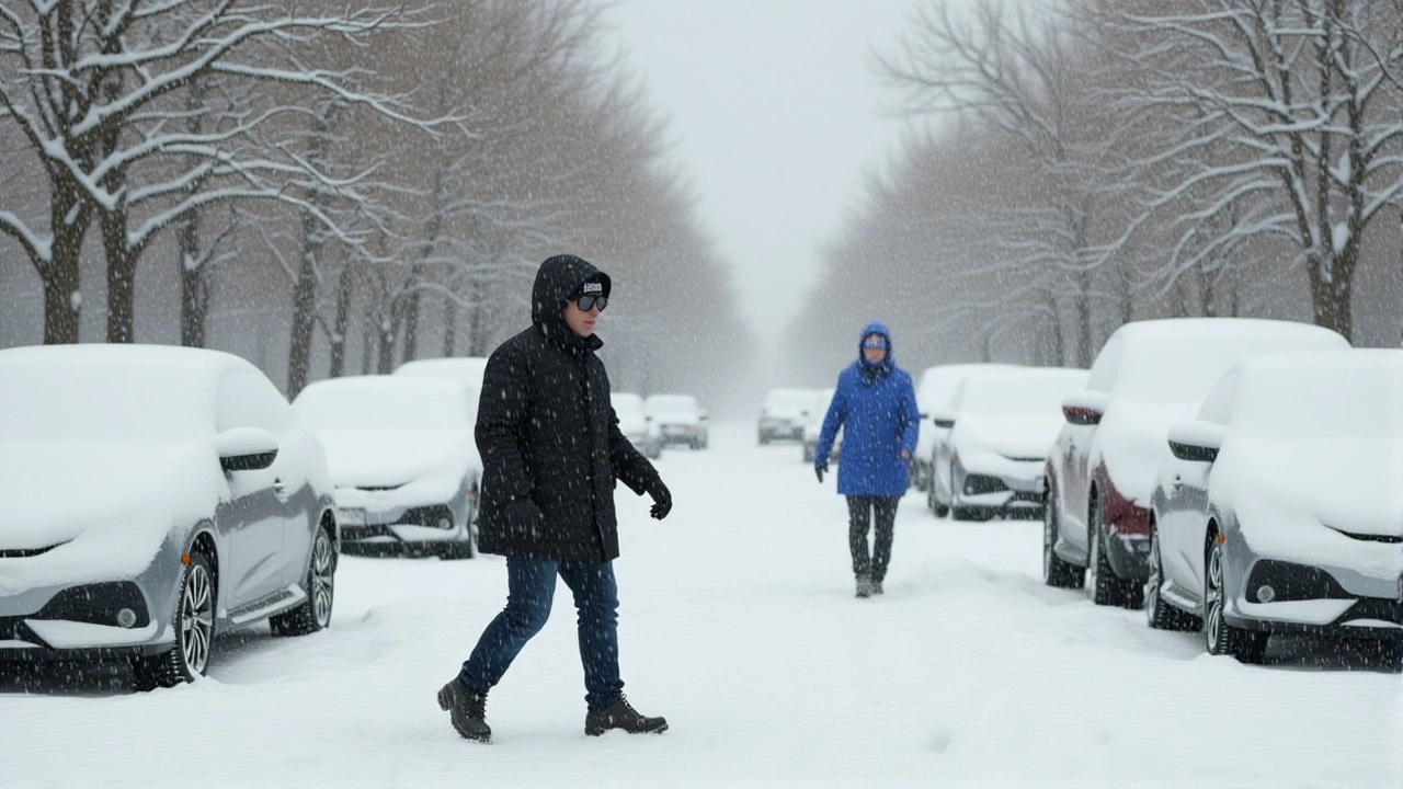
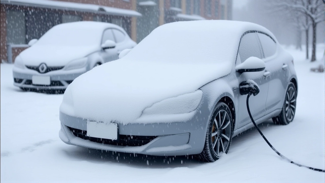
Blizzard‑like conditions slapped the Southwest Louisiana coast with wind gusts of 30‑40 mph, slashing visibility to a few yards. The fallout was immediate: over 200 miles (320 km) of Interstate 10 were shut, grounding flights at the New Orleans Louis Armstrong Airport and Mobile Regional Airport. Emergency crews struggled to keep highways clear, and power outages left thousands without heat during the deep‑freeze nights.
Local businesses reported losses upward of $2.3 million combined, with restaurants and retailers forced to close for up to three days. The storm’s economic ripple was felt beyond the immediate area, as supply chains that rely on I‑10 traffic were delayed, prompting a brief spike in freight rates.
Meteorological Mechanics
The storm’s engine was a classic “lake‑effect” scenario, only the lake was the warm Gulf of Mexico. By January 20, a deep upper‑level trough pushed southward from the Great Lakes, funneling Arctic air across Texas and Louisiana. Meanwhile, a surface low formed over the central Gulf, sucking moist air northward. When the frigid, dry air undercut the Gulf’s moisture, it produced narrow, intense bands of snowfall that tracked inland like conveyor belts.
"Think of it as a snow‑making machine sitting at sea level," explained Mark Sullivan, senior forecaster at the National Weather Service. "The temperature gradient was so sharp that the snow crystals stayed fluffy, leading to that high snow‑to‑liquid ratio we observed."
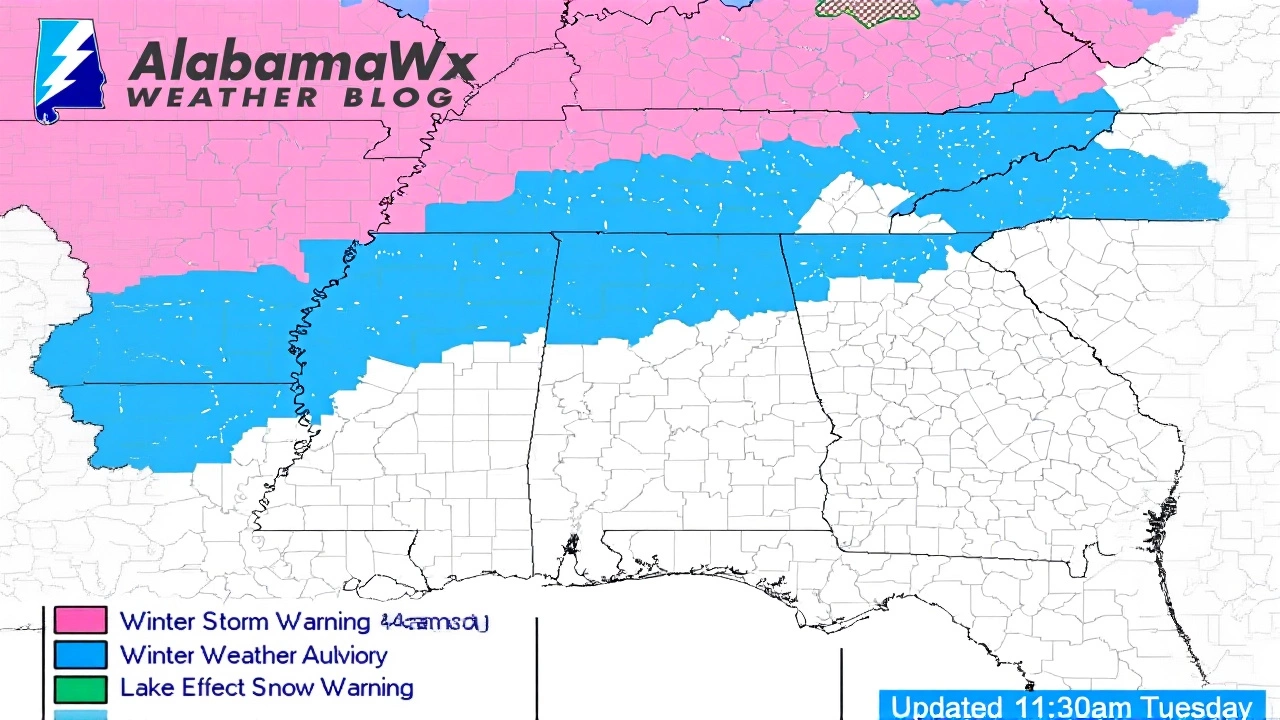
The event was the fourth major winter system to strike North America within a two‑week window, following a Midwest blizzard (Jan 5‑6), a Deep South snowstorm (Jan 9‑11), and a Northeast nor’easter (Jan 19‑20). Such clustering is rare and has sparked discussion about potential links to Arctic amplification.
Broader Climate Implications
Scientists caution that while a single snowstorm isn’t proof of climate change, the increasing frequency of extreme weather clusters aligns with model projections of a more volatile jet stream. The 2025 Gulf Coast blizzard, with its record‑breaking depths and unprecedented cold, may become a case study in how warming Arctic waters can destabilize atmospheric patterns.
Policy makers in Louisiana and Alabama are already reviewing emergency‑management protocols, aiming to improve winter‑weather readiness in regions historically unprepared for such conditions.
Key Facts
- Event dates: January 20‑22, 2025
- Lowest temperature: 7°F in Baton Rouge (coldest in 95 years)
- Record snowfall: Pensacola 8.9 in, Mobile 7.5 in
- Snow‑to‑liquid ratio: 10:1‑15:1 (unusually high for low‑elevation sites)
- Transportation impact: 200+ mi of I‑10 closed, multiple flight cancellations
Frequently Asked Questions
How did the snowstorm affect daily life in Baton Rouge?
Residents faced icy road conditions, power outages, and school closures for two days. The 7°F temperature forced many to rely on backup generators, and local authorities declared a state of emergency to mobilize snow‑clearing crews.
What caused the unusually high snowfall-to-liquid ratio?
The deep, dry Arctic air kept the snow crystals small and airy, preventing them from melting into heavier flakes. This high ratio, typical of mountain snow, meant that a modest amount of moisture turned into a surprisingly large snow depth.
Are such Gulf Coast snowstorms becoming more common?
While still rare, the clustering of multiple severe winter events in January 2025 suggests a shift in atmospheric patterns. Researchers are monitoring the trend, linking it to a more erratic jet stream influenced by Arctic warming.
What economic impact did the storm have on the region?
Preliminary estimates place direct losses at around $2.3 million for small businesses due to closures, plus additional costs for snow removal, road repairs, and disrupted freight shipments along I‑10.
What steps are officials taking to prepare for future winter events?
State emergency management agencies are updating winter‑weather response plans, increasing snow‑plow inventories, and conducting public awareness campaigns about staying safe during extreme cold snaps.